Last Updated: February 28, 2019
This is my holding place for project descriptions while I get them all identified. *These are draft descriptions.* Keep in mind that research projects can change quite a bit. That is part of the nature of research. You don't know how things will work out when no one has done your project before.
I put a link to a recent REU project for that mentor, when possible. That doesn't mean the proposed project is like that one, but will give you a flavor of that mentor's research. Likewise, some projects have "most directly applicable majors" listed. This does not necessarily limit who can choose the project, but instead is meant to reveal something of the nature of the project. If you have any hesitation or doubt or questions about a project please ask some questions before ranking it.
1. Which factors influence tornado production in landfalling tropical cyclones?
Mentor: Dr. Ben Schenkel (OU CIMMS & SoM)
Landfalling tropical cyclones are capable of producing tornadoes that can compound the damage inflicted by other tropical cyclone hazards (e.g., storm surge). However, there remains uncertainty regarding why tropical cyclones with similar landfalling intensities and locations can produce order of magnitude differences in tornadoes during their lifetime. Much of this uncertainty likely originates from the lack of a complete physical understanding of which factors influence tornado production. Recent work has suggested the importance of ambient deep-tropospheric vertical wind shear in impacting the location and frequency of tornadoes in landfalling tropical cyclones, which may help explain interstorm variations in tornado production when considered together with other previously identified salient factors. Leveraging this recent work, the proposed project will examine which factors influence the large variability in tornado production in landfalling tropical cyclones by examining case studies of storms with similar landfalling locations and intensities. We hypothesize that tornado production is greatest in large tropical cyclones undergoing strong ambient deep-tropospheric vertical wind shear. The proposed analysis will utilize a combination of observations, radar data, and model data to address the proposed hypothesis. This project will serve as part of a broader climatological assessment of the antecedent environmental conditions associated with tornadoes in landfalling tropical cyclones.
Desired skills: Background in atmospheric science and programming is desired, but not necessary.
Most directly applicable majors: atmospheric science
2. Analysis of the diurnal cycle of tropical rainfall and cloud populations during DYNAMO field campaign
Mentor: Dr. Naoko Sakaeda (OU SoM)
The diurnal cycle is one of the fundamental modes of atmospheric variability. The diurnal cycle explains the dominant fraction of tropical rainfall variability and it is tightly associated with the initiation and growth mechanism of cloud systems. In contrast to the typical afternoon peak of rainfall over land regions, oceanic tropical rainfall and deep convection often peak between midnight and early morning hours. The physical/dynamical mechanism behind this nocturnal peak of rainfall is still not well understood. To better understand the diurnal cycle of tropical rainfall, this project will use ground-based radar observations that are obtained during the DYNAMO field campaign over Indian Ocean to achieve a detailed understanding of how precipitating cloud populations evolve diurnally.
Desired, but not necessary skills: Background in atmospheric sciences, mathematics, and statistics; some experience with computer programming
3. Analyzing Rare Tornado Events and Their Impacts
Mentors: Kenzie Krocak (OU SoM & CIMMS/NSSL) and Dr. Harold Brooks (NSSL)
Even with higher resolution models and new forecasting techniques, tornadoes continue to cause loss of life and property damage each year in the United States. While tornadoes are inherently rare events, some occurrences are rarer than others (i.e. nocturnal or winter events vs. afternoon, springtime events). This project will utilize an hourly climatology of tornado events based off of Storm Prediction Center reports (Krocak and Brooks 2018) to identify and investigate the rarest tornado occurrences to date. Atmospheric conditions and socioeconomic factors will be analyzed to identify potential links between tornado rarity and resulting impacts.
Desired skills: Background in atmospheric science and programming is recommended.
Most directly applicable majors: Atmospheric science, meteorology.
4. Winter precipitation and traffic fatalities
Mentors: Dr. Andrew Rosenow (CIMMS/NSSL), Dr. Heather Reeves (CIMMS/NSSL), and Shawn Handler (REU 2014 alum; CIMMS/NSSL))
Winter weather related vehicular collisions are a significant cause of weather-related losses and fatalities each year, accounting for an order of magnitude more fatalities than the direct fatalities from other types of high-impact weather (tornadoes, hail, heat, cold, floods, etc.). Despite this, we do not have a good understanding of exactly what types of winter storms are most dangerous to drivers. This project will involve performing basic statistical analysis of National Highway Traffic Safety Administration (NHTSA) Fatality Accident Reporting System data to find collisions with fatalities occurring during winter precipitation. Multi Radar/Multi Sensor (MRMS) radar mosaic data, surface observations, and other meteorological data will be used to classify the properties of the storm (size, precipitation type, precipitation intensity, etc.). The goal of this project is produce a database of winter storm events for future research at NSSL, as well as to provide actionable guidance to forecasters and researchers on types of winter storms that need additional research and public messaging efforts to improve roadway safety.
Desired skills: Programming experience (Python), or computing/UNIX experience and willingness to learn Python
Most applicable majors: Atmospheric science/meteorology
5. REU Project Topics With the Oklahoma Mesonet
Mentor: Dr. Brad Illston (OCS)
There are several topics available. Choose one topic below if choosing this mentor.
Eclipse Temperature Inversion
On August 21, 2017, a solar eclipse passed across the United States. The Oklahoma Mesonet collected 1-minute resolution data during the event. This project will analyze the air temperature data at 1.5m and 9m to determine how the surface layer and inversions changed during the passing of the eclipse.
Requirements: Basic Unix/Linux, Programming experience
Radar Rainfall Estimates vs. Station Rainfall Data
Radar estimates of rainfall are used in many applications including hydrological modeling and flood forecasting. This study will compare Oklahoma Mesonet rainfall measurements to the Stage 4 NWS Arkansas-Red Basin River Forecast Center rainfall estimates from WSR-88D QPE. They use the P3 precipitation estimator designed specifically for the ABRFC, which incorporates the Oklahoma Mesonet data to adjust the radar estimates.
Requirements: Basic Unix/Linux, Programming experience
Objective Analysis Schemes for Mesoscale Variables
Understanding the various methods for performing objective analysis on meteorological data sets is important in how this information is interpreted by end users. Different variables respond differently to objective analysis techniques mainly due to their horizontal and/or vertical spatial variability. This project will determine the accuracy of various objective analysis techniques through a systematic statistical approach of correlating interpolated values from actual Mesonet data values. The project will also analyze the accuracy by time of day and time of year, as well as, understanding how the exclusion of multiple input data points might impact accuracy results.
Requirements: Basic Unix/Linux, Programming experience (some tools are already written in Perl, but could be rewritten by student if needed)
Evapotranspiration Estimations and Validation (w/ Dr. Jeffrey Basara)
Land-atmosphere interactions play an important role in influencing weather and climate on both local and regional scales. Quantifying the variability of evapotranspiration (ET), which is a critical link to land-atmosphere interactions, would contribute to a better understanding of drought development and alleviation during dry periods. A previous study estimated ET at Oklahoma Mesonet sites across Oklahoma from 2000 to 2013 by combining in situ data and normalized difference vegetation index (NDVI) values from MODIS sensors from Terra and Aqua satellites via the Mesonet Evapotranspiration Model (MEMo). The MEMo was validated using flux data from an enhanced station in Marena, OK. This study will further validate and adjust the MEMo utilizing additional data from Marena as well as additional enhanced stations in El Reno and Washington, OK.
Requirements: Basic Unix/Linux, Programming experience (some tools already written)
6. Urban microclimates, mosquito habitats, and disease transmission risks
Mentor: Dr. Mike Wimberly (OU DGES)
Mosquito-transmitted viruses (arboviruses) such as dengue, chikungunya, and Zika are a human health threat of worldwide significance. Dr. Wimberly’s research group is developing models to predict where these diseases are most likely to emerge by mapping environmental risk factors at the neighborhood scale in cities across the United States. The work involves creating fine-scale maps of urban microhabitats within cities, connecting microclimate data with epidemiological models to predict mosquito habitat suitability and disease transmission risk, and developing new computer software to support large-scale predictive risk mapping. There are opportunities for student researchers to participate in several facets of this project, including field work collecting data on microclimates and mosquito populations, developing and testing new instrumentation for microclimate monitoring, and analyzing satellite remote sensing and other geospatial datasets to map the urban environment.
Desired characteristics: Strong interest in studying the connections between meteorology and disease ecology, willingness to participate in field work, interest in working with GIS and remote sensing
7. Analysis of Tornadic Datasets from the Atmospheric Imaging Radar
Mentors: Andrew Mahre (REU 2013 alum; ARRC/SoM) and Dr. David Bodine (ARRC)
From 2012 to present, the Advanced Radar Research Center’s (ARRC’s) Atmospheric Imaging Radar (AIR) has collected data on numerous tornadoes and both tornadic and nontornadic supercells. The AIR is a rapid-scan, phased array radar capable of obtaining volume scans in only 5 to 10 s, thus providing the temporal resolution needed to understand rapidly evolving processes in supercells and tornadoes. The goal of this project is to use AIR data from tornadic and/or non-tornadic supercell cases to further study tornado and mesocyclone dynamics. Possible topics for this project could include 1) improvement and verification of a single-Doppler wind retrieval method (the GBVTD method) using both AIR data and data from SimRadar (a polarimetric tornadic debris simulator), 2) case studies of tornadogenesis failure, in which strongly rotating supercells did not produce a tornado, or 3) a case study of one of three violent tornadoes from 2013. The exact choice of topic will be partially at the discretion of the student, but will also depend upon which datasets are available and applicable for each topic. The first few weeks of the REU will also coincide with ARRC field experiments with a mobile phased array radar and a small X-band, dual-polarization radar network deployed in the Oklahoma City area. The student will have opportunities to participate in these field experiments.
Desired skills: Programming skills in Matlab and/or Python preferred
Most directly applicable majors: Atmospheric science and/or meteorology, physics, math
8. Building Simple Climate System Models for Instruction and Research
Mentor: Dr. John T. Snow (CA&GS Dean’s Office and SOM)
Toy models are deliberately simplistic models in which only essential physical processes are represented. Their functioning is easy to understand, so they can help in understanding the role of a process in a more complete model. Toy models can also very useful as instructional tools. Using the STELLA modeling and interactive simulation software ( https://www.iseesystems.com/store/products/stella-architect.aspx), I have been developing a sequence of toy models of a climate system analogous to Earth's. The intent is to use this sequence of models to explore the interactions of various physical processes, such as the poleward transport of energy, which can then be tested against observations and the results of more realistic (and much more complex) climate models. In this project, I would work with the student to develop the next model in the sequence. The student have discretion in formulating very simple representations of the meridional transport of energy by the atmosphere and oceans from the Equatorial Tropics to the Polar Regions.
Requirements: Undergraduate physics and ordinary differential equations for scientists and engineers; ability to learn and apply a new software package (STELLA) quickly.
9. It’s not a Suggestion, it’s a Demand: The Atmosphere Needs its Moisture. Is Oklahoma becoming a desert?
Mentors: Ryann Wakefield (REU 2015; SOM), Jordan Christian (SOM), and Dr. Jeffrey Basara (SoM & CEES)
In regions which lie between dry and moist climates, such as Oklahoma, there is an increased sensitivity of vegetation to changes in atmospheric demand for water vapor sourced via evapotranspiration, or evaporative demand. High evaporative demand drives increased amounts of evapotranspiration and places excessive stress on ecosystems, which can impact one of the region’s most important resources, agriculture. Oklahoma has a diverse range of ecosystems from near desert, to tallgrass prairie, to forested rolling hills and swamps. The biodiversity of this region is influenced by evaporative demand, as the vegetation of the western prairies is subjected to high evaporative demand more frequently than the forested hills to the east. Recent research suggests that the original transition line from desert to prairie to forest, once along the 100th meridian, has been shifting further east. This project will examine temporal and spatial trends in evaporative demand across Oklahoma to determine whether this shift in the “100th meridian” can be detected by and is attributable to changes in evaporative demand. Impacts of this shift range from changes in agricultural planting practices to the location of the dry-line, so it is critical that we understand the cause of this shift. To answer this question, we will use both observational data from the Oklahoma Mesonet, reanalysis, and model data. There may also be opportunities to visit field stations operated by the CHEWe research group to understand more about the local ecosystems, and instrumentation we use to study such problems.
Desired skills: Some beginner/introductory programming experience in Python or MATLAB would be helpful but not necessary.
10. Rapid-Update Radar Data and its Use in Severe Weather Warning Decisions
Mentors: Charles Kuster, Dr. Terry Schuur (CIMMS/NSSL), and Vivek Mahale (NWSFO Norman)
Severe weather events, such as tornadoes and downbursts, evolve very quickly. Therefore, it is important to collect radar data as quickly as possible to sufficiently observe these events and provide the public with life-saving information. To test the potential operational benefits of rapid-update radar data, researchers have been operating a research dual-polarization radar using specialized sector scanning to collect data with < 2 min updates of many different storm types and intensities. The purpose of this study will be to identify and analyze useful dual-polarization signatures and explore potential benefits of rapid-update radar data to National Weather Service (NWS) forecasters. Potential cases for analysis include tornadic and nontornadic supercells and quasi-linear convective systems, as well as downburst-producing thunderstorms. The student will have the opportunity to analyze unique radar datasets and interact with NWS forecasters to learn about the warning decision process. Mentors will be available to teach and help with any data analysis and research skills needed to complete the project.
Desired skills: Background in atmospheric science and willingness to learn radar data analysis techniques and basic programming.
11. The Role of the Great Plains Nocturnal Low-Level Jet in Nighttime Convection Initiation
Mentors: Dr. Elizabeth Smith (CIMMS/NSSL) and Dr. Petra Klein (OU SOM)
In 2015, the Plains Elevated Convection At Night (PECAN) campaign collected unprecedented and novel observations of the nocturnal boundary layer and phenomena within it. From this dataset new findings have indicated that the spatial-temporal evolution of heterogeneous nocturnal low-level jets (NLLJs) may play an important role in otherwise pristine nocturnal convection initiation (CI). However, most of our analyses have been limited to a few specific PECAN cases (so-called NLLJ missions). This project will expand on recent studies by analyzing data from additional missions that targeted bores, mesoscale convective systems, and CI, but the NLLJ was observed with the objective to understand how the NLLJ may contribute to nocturnal CI. The project will mainly focus on analysis of the available observations, but the opportunity exists for inclusion of model reanalysis data and/or numerical simulation methods.
Desired skills: background or focus in atmospheric science/meteorology, interest in learning or growing computer programming skills, interest in observations
Most directly applicable majors: atmospheric science/meteorology
12. Evaluating error characteristics of a real-time convection-permitting ensemble forecast system during HWT SFE
Mentors: Dr. Aaron Johnson (OU SOM) and Dr. Xuguang Wang (OU SOM)
Numerical model guidance is an increasingly important part of the operational severe weather forecast process. Understanding the error characteristics of such guidance is important for continued improvements to the model physics and ensemble diversity configurations. The Multiscale data Assimilation and Predictability (MAP) lab at OU runs a real-time 10-member convection-permitting ensemble system each spring during the Hazardous Weather Testbed Spring Forecasting Experiment.
These forecasts will be verified against various observation datasets (e.g., radar based precipitation and hail retrievals, severe weather reports and storm warnings, radar reflectivity) to statistically characterize errors in both the ensemble probabilistic forecasts and deterministic forecasts from individual ensemble members.
This model verification study will allow the student to develop hypotheses about potential calibration techniques that may have improved the ensemble performance during the HWT. Preliminary testing of such hypotheses will be possible using standard calibration methods of separating "testing" and "training" data.
Applicable majors: Atmospheric Sciences, Statistics, Math, Computational Physics
Preferred, but not necessary skills to have: An introductory class in Numerical Weather Prediction and/or very basic understanding of the concepts of the following--> statistical significance, probability distribution, finite difference approximations
Skills/experience to be gained: Programming simple codes to analyze big datasets, practical issues regarding interpretation and calibration of NWP guidance in the context of severe weather forecasts.
13. Preparing to adapt: Are people’s expectations in line with climate projections?
Mentors: Emma Kuster (South Central CASC), Dr. Joe Ripberger (CRCM), Dr. Adrienne Wootten (South Central CASC), Dr. Derek Rosendahl (South Central CASC)
Climate change has already started to affect the world in which we live. To best adapt to these changes, people need to be aware of what the changes might be like. While climate projections and reports have been public for years, we wonder if people’s expectations match the projections or if there is a disconnect. If people’s views of the future do not reflect what the climate projections tell us, then perhaps that means we need to do a better job of educating the public about projected changes in climate. Through the use of an existing survey dataset that has asked people about their expectations of future extreme events, this project will investigate whether or not people’s expectations match downscaled climate projections for Oklahoma. If time permits and the student is interested, we may be able to explore further some potential links between their expectations for future extreme events and their current views of climate change.
Desired skills: Experience with, or willingness to learn, statistics, ArcGIS, and programming in R
14. REU Topics with the Center for Autonomous Sensing and Sampling (CASS)
Mentors: Brian Greene (SoM & CASS & OU/ARRC), Tyler Bell (SoM & CASS), and Dr. Elizabeth Pillar-Little (SoM & CASS)
There are several topics available. Choose one topic below if choosing this mentor team.
1) Characterization of Rotary-Wing Unmanned Aircraft System Propeller Downwash Impact on the Ambient Environment
Recent research has shown that thermodynamic observations from rotary-wing unmanned aircraft systems (rwUAS) compare reasonably well to more historically established systems (e.g. radiosondes). However, rwUAS naturally affect their environment as they fly, which can bias measurements made by the platform. The extent to which rwUAS can affect their environment (especially close to the surface) has not been adequately measured in an idealized setting. For this project, the student would assist in developing a miniaturized, fast response meteorological sensing package to characterise the footprint of an rwUAS developed by CASS. Experiments to determine the footprint using the sensor package will also be performed in the field under varying stability regimes.
Desired, but not necessary skills: computer programming skills in python and/or MATLAB, experience with arduino and circuitry
Directly applicable majors: atmospheric science/meteorology, physics, engineering
2) Spatio-temporal Variability in Kinematics and Thermodynamics Prior to Convective Initiation
During July 14-21, 2018, the Lower Atmospheric Process Studies at Elevation - a Remotely-piloted Aircraft Team Experiment (LAPSE-RATE) field campaign took place in the San Luis Valley in south-central Colorado. During this campaign, the University of Oklahoma (OU) deployed state-of-the-art weather observing rwUAS platforms to study convective initiation, morning PBL transitions, and drainage flows from the surrounding mountain ranges. As part of LAPSE-RATE, OU deployed mobile UAS teams to different locations in the valley. There were also multiple other universities deployed throughout the valley. This project would focus on days when convective initiation occurred. The goal is to characterize the boundary layer throughout the valley leading up to convective initiation using the numerous UAS that were in the valley.
Desired, but not necessary skills: computer programming skills in python and/or MATLAB
Directly applicable majors: atmospheric science/meteorology, physics, math
3) UAS Observations of Ultra-Stable Arctic Winter Atmospheric Boundary Layers
In February 2018, the Innovative Strategies for Observations in the Arctic Atmospheric Boundary Layer (ISOBAR) field campaign took place on the Finnish island of Hailuoto. ISOBAR aimed to better understand ultra-stable conditions present in the Arctic above sea ice in the wintertime to improve numerical weather prediction boundary layer parameterizations. To achieve these goals, this campaign leveraged recent advancements in atmospheric sampling with UAS in conjunction with observations from flux towers, sodars, and a lidar. OU contributed to UAS operations by flying continuous profiles throughout nighttime transitions of the PBL over a period of four weeks. This project would focus on synthesizing and analyzing data collected from the campaign to advance understanding of physical processes present in these extreme environments.
Desired, but not necessary skills: computer programming skills in python and/or MATLAB
Directly applicable majors: atmospheric science/meteorology, physics, math
4) Spatio-temporal Variability of the Chemical Composition of the Atmospheric Boundary Layer
Trace gas and aerosol concentrations have systematically been measured using ground-based observing stations, aircraft, and satellites for many years in order to better model air quality and assess chemical drivers of climate variability. However, current methods do not provide high resolution of the vertical structure of these constituents in the lowest 1-2 km of the troposphere. We propose that miniaturized chemical sensors deployed on fixed or rotary wing UAS provides an opportunity to collect spatially resolved vertical profiles on diurnal, seasonal, or annual scales. This project would focus on the characterization, testing, and integration of a chemical sensing payload to examine ozone or aerosol size/number density gradients in the troposphere.
Desired, but not necessary skills: computer programming skills in python and/or MATLAB, experience with circuitry
Directly applicable majors: chemistry, atmospheric science, meteorology, engineering
15. Lower troposphere dynamics through the eyes of remote sensing and drone observations
Mentors: Sean Crowell (GeoCarb), Dr. Jeff Basara (SoM & CEES), Dr. Liz Pillar-Little (SoM & CASS), Dr. Dave Turner (NOAA/ESRL/GSD), Dr. Xiao-Ming Hu (CAPS)
Atmospheric dynamics within and above the planetary boundary layer is an active area of research that is being explored through modeling as well as many different types of observations. This project entails the use of various types of measurements of trace gases like carbon dioxide from drone platforms, surface samples, and remote sensors to better understand vertical motions throughout the day as the convective boundary layer develops, with particular focus on the Southern Great Plains region. The student will use these data sets and other observations of temperature, winds, and water vapor to diagnose the evolution of the boundary layer throughout the spring and summer. Part of the project will involve the student supporting data collection opportunities at the nearby KAEFS research facility, as well as potentially the Department of Energy Southern Great Plains research center near Lamont, Oklahoma.
16. Using Wideband FMCW Radar for Pre-Avalanche Detection
Dr. Jay McDaniel (ECE & ARRC) and Dr. Justin Metcalf (ECE & ARRC)
Avalanches are a major concern for many outdoor enthusiasts including climbers and backcountry skiers. Although many efforts have been put forth to mitigate risks, the unpredictability of avalanches still results in several deaths annually. Highlighting the dangerous unpredictability of avalanches, a group of well-trained individuals were recently partaking in an advanced avalanche course offered by the Colorado Silverton Avalanche School when an avalanche was triggered, resulting in a fatality. This event exemplifies the dangers associated with avalanches and the need for newer technologies to aid in pre-avalanche detection.
In some avalanche prone areas, radar technology is currently being used to monitor the movement of an avalanche through means of a Doppler shift in the radar’s frequency content. This method is ideal for triggering warnings for railroads and underpasses but can only detect an avalanche that has already begun. Therefore, this project will produce a paper study on the potential of a frequency-modulated continuous wave (FMCW) radar to detect dangerous conditions where an avalanche is likely to initiate. Specifically, this project will investigate and characterize the conditions that lead to avalanches, such as mountain slope angles and snow stack-up characteristics that yield a high probability of avalanche initiation. Armed with an understanding of these conditions, a paper design will be conducted to determine requirements for an FMCW radar capable of creating echograms of sufficient quality to detect and localize areas of high avalanche probability.
Desired, but not necessary skills: interest in radar, remote sensing, and applied electromagnetics
Directly applicable majors: physics, geoscience, and electrical engineering
17. Do lightning characteristics evolve with the rear flank downdraft in a high-precipitation supercell?
Dr. Vanna Chmielewski (NRC/NSSL); Dr. Alex Fierro (CIMMS & NSSL); Dr. Ted Mansell (NSSL)
The Oklahoma Lightning Mapping Array (OKLMA) is an array of stations which can triangulate the Very High Frequency (VHF) radio emissions along lightning channels in 3-dimensions with high temporal and spatial accuracy, mapping how each lightning flash develops. Where the flashes initiate and what regions the channels propagate into can inform us of where charged hydrometeors collect within a storm. The updraft regions of supercells provide an ideal environment for the non-inductive collisional charging of hydrometeors, promoting high flash rates around the updraft core. The electrification of these hydrometeors is sensitive to their local environmental conditions, specifically supercooled liquid water content and ambient temperature. Therefore, the altitudes where charge of each polarity accumulates can vary sometimes substantially within a single storm both temporally and spatially. The high-precipitation supercell of 29-30 May 2004 near Geary, Oklahoma was a prolific lightning-producer well observed by the OKLMA and mobile radars for about 1.5 hours, allowing for detailed examination of storm evolution near peak intensity. Ongoing analysis has shown spatially distinct regions of electrification corresponding to local regions of updraft surrounding the mesocyclone, as revealed by dual-Doppler analysis. The primary goal of this project is to determine if any temporal variations in net charge layer heights (or other flash characteristics) on the western flank of the storm coincided with the evolution of the rear flank downdraft.
Desired skills: background or focus in atmospheric science/meteorology or atmospheric physics, interest in observations. Minimal programming skills are required and can be easily acquired during the project.
Most directly applicable majors: atmospheric science/meteorology, physics
18. Incorporating Climate Adaptation Practices into City Planning in Oklahoma
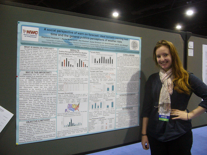
Rachel Riley (REU 2007; SCIPP)
Climate adaptation is increasingly at the forefront of decisions that are made among city officials across the country, but for a variety of reasons is not often considered in city planning decisions across Oklahoma. This project will build on the engagement and research that the Southern Climate Impacts Planning Program (SCIPP) has been conducting for a few years related to hazard mitigation, climate adaptation and community resilience. The student will conduct 2-3 prospecting interviews to gather background information, develop an online survey that will be sent to city planners and possibly other city officials across Oklahoma, analyze the results, and provide recommendations for next steps. SCIPP is a stakeholder-driven research program, and this project will provide the opportunity for the student to learn how climate information has the potential to impact real-world decisions.
Desired characteristics: Interest in climate and learning social science methodologies.