May 26 - August 2
TABLE & FIGURE CAPTIONS
Table 1. Percentage of severe weather by type for 1982 and 1989.

Table 2. Types of Multiple Baroclinic Structure.
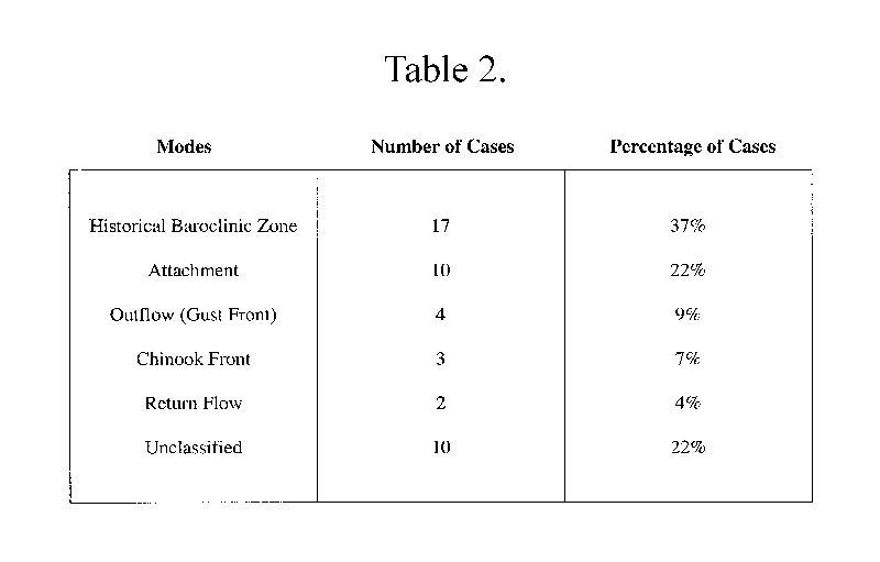
Figure 1. Reproduction of RW26's sea level pressure analysis (in inches of mercury) for 0100 UTC 18 February 1926; Cp was analyzed as a cold front, W1 as a warm front, C2 as a secondary cold front, and D1 as the low pressure center. Areas of precipitation are shaded. From Hobbs et al. (1996).
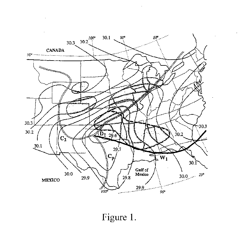
Figure 2. Schematic illustrating some of the criteria used in identifying baroclinic zones. A and C are baroclinic zones because they are coincident with a gradient of at least 8°F (4.4°C) per 220 km, are at least 440 km long, and are separated by an area with a gradient of no more than 4°F (2.2°C) per 220 km. A is the northern baroclinic zone and C is the southern baroclinic zone. B and D are not baroclinic zones: D is not long enough, and B is the synoptic cold front which are excluded in this study. The wind barbs along baroclinic zone C are from the stations that would be used to calculate the average wind and dewpoint on each side of the baroclinic zone.
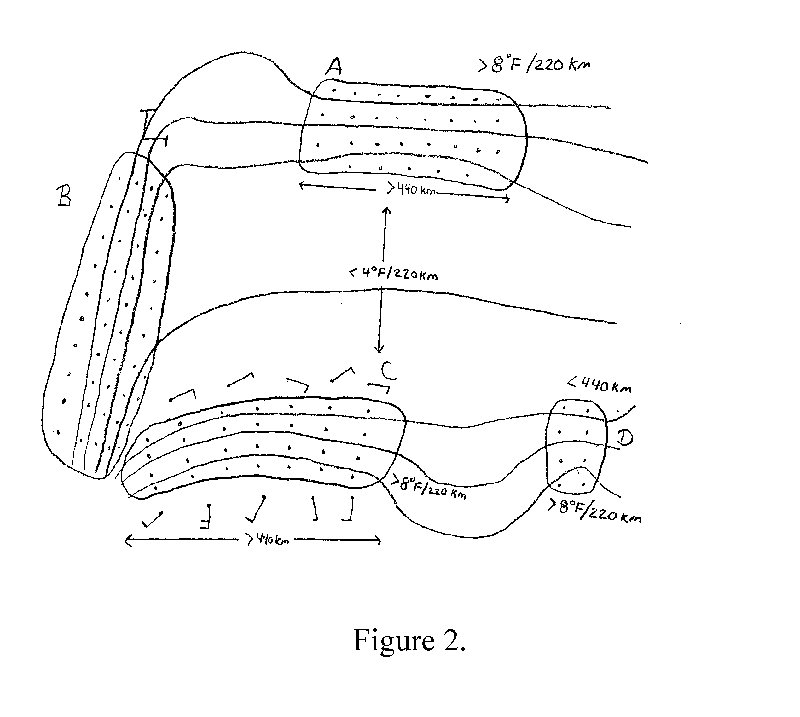
Figure 3. Percentage of cyclones with multiple baroclinic zones from each month. Number of events per month are labeled along the line.
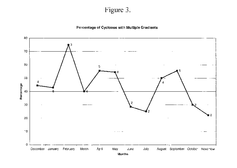
Figure 4. Seasonal distribution of 18 UTC northern (solid line), central
(long dashed line), and southern (short dashed line) baroclinic zones
for cyclones with multiple baroclinic zones. (a) winter, (b) spring, (c)
summer, (d) autumn.
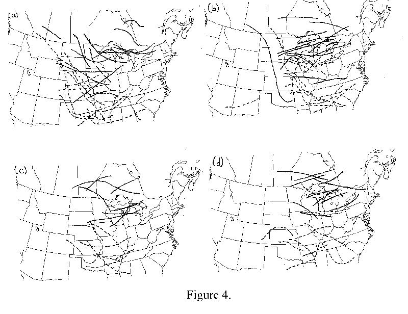
Figure 5. The change in wind direction (from the cold side to the warm side) across every identified baroclinic zone. Wind direction values were obtained from the five stations on each side of the baroclinic zones as illustrated in Fig. 2 and described in the text. Positive numbers indicate veering winds while negative numbers indicate backing winds. The labels for each bin indicate the first value included. (e.g., 0 represents values greater than or equal to zero, but less than 20).
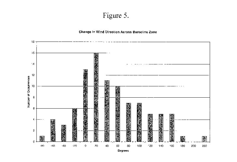
Figure 6. The percentage of multiple baroclinic zones that were associated with severe weather (dark solid), significant severe weather (light solid), tornado (dark dashed), and significant tornado (light dashed) for each season.
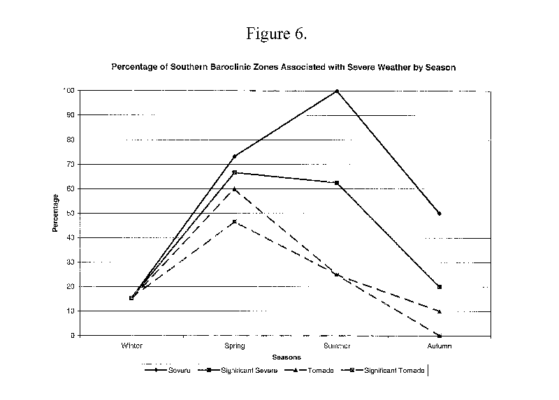
Figure 7. (a) Number of occurrences of southern baroclinic zones as a function of dewpoint temperature. Southern baroclinic zones with severe weather reports (as described in the text) are represented by dark gray shading, whereas southern baroclinic zones without severe weather reports are represented by light gray shading. The labels for each bin indicate the first value included. (e.g., 56 represents values greater than or equal to 56, but less than 60). (b) Same as (a) except for significant severe weather.
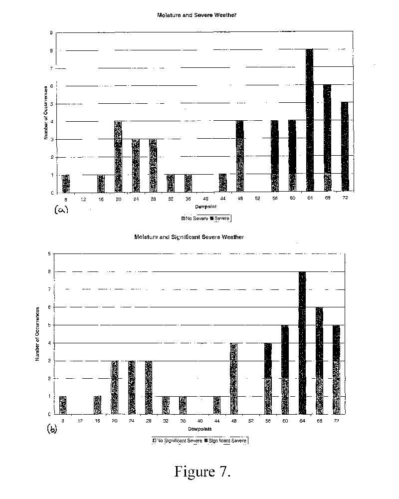
Figure 8. Schematic illustrating the Historical Front mode of secondary baroclinic zone development. Hs and Ls represent the position of surface highs and lows, respectively. Frontal notation is standard.
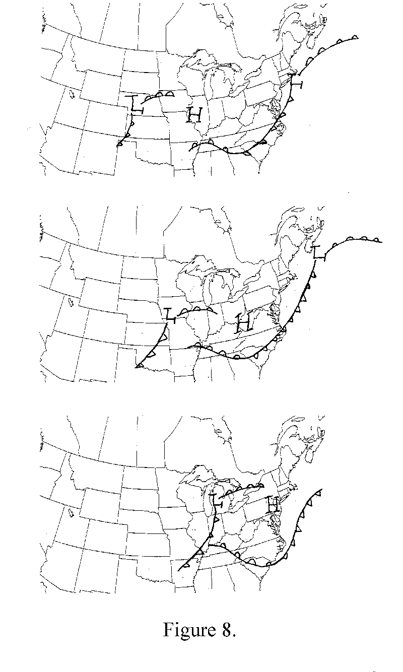
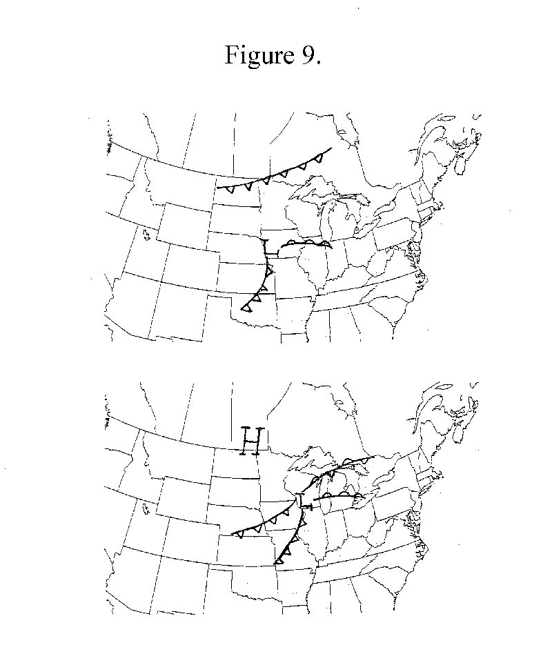
Figure 9. Schematic illustrating the Attachment mode of secondary baroclinic zone development. Hs and Ls represent the position of surface highs and lows, respectively. Frontal notation is standard.