Last Updated: April 23, 2021
This is our holding place for project descriptions while we get them all identified. *These are draft descriptions.* Keep in mind that research projects can change quite a bit. That is part of the nature of research. You don't know how things will work out when no one has done your project before.
I put a link to a recent REU project for that mentor, when possible. That doesn't mean the proposed project is like that one, but will give you a flavor of that mentor's research. Likewise, some projects have "most directly applicable majors" listed. This does not necessarily limit who can choose the project, but instead is meant to reveal something of the nature of the project. If you have any hesitation or doubt or questions about a project please ask some questions before ranking it.
The following projects will be funded through this REU:
1. Understanding the structure of close-range tornado debris signatures
Mentor: Dr. David Bodine (ARRC) and Rachael Cross (ARRC & SoM)
Tornado debris signatures (TDSs) are important to operational applications, such as tornado detection and intensity estimation, as well as understanding the three-dimensional structure of tornadoes and debris. High-resolution simulations have shown that the internal structure of the tornado debris signature can be quite complex, particularly for radars observing TDSs at close range. For this project, the student will examine the three-dimensional structure of tornado debris signatures using archived NEXRAD and mobile radar dual-polarization observations.
Desired skills: Matlab/Python experience preferred, interest in radar observations beneficial
Most applicable majors: Meteorology, geography, mathematics/physics
Recent REU projects with this mentor:
- Tornadoes in the Southeast United States: Investigating the Relationship between Intensity, Damage, and Terrain
- NWS Analysis of Tornadogenesis Failure Using Rapid-Scan Data from the Atmospheric Imaging Radar
- Dual-Wavelength Polarimetric Radar Analysis of the May 20th 2013 Moore, OK, Tornado
- Observations of a Supercell and Weak Tornado Made With a Rapid-scan, Polarimetric, Mobile Radar
2. Quantification of the Error Characteristics of the MRMS Q3DP Product
Mentors: Heather Grams (NOAA/NSSL), Steve Martinaitis (OU/CIMMS & NOAA/NSSL), and Race Clark (OU/CIMMS & NOAA/SPC)
New Multi-Radar Multi-Sensor (MRMS) system domains were recently established over areas outside the CONUS (hereinafter denoted as oCONUS). A dual-polarization based precipitation estimation algorithm, called Q3DP, was implemented for these domains with an evaporation correction scheme. These upgrades to the way MRMS estimates precipitation represent a significant improvement in accuracy over precipitation estimation techniques that are reflectivity-based. Previous studies have quantified various biases in the Q3DP product over the CONUS; however, the biases and challenges of the Q3DP product over domains like Alaska and Hawaii, which have limitations with radar coverages and radar blockages, have not gone through large-scale quantifications. This study will focus on the quantification of the error characteristics of the MRMS Q3DP product based on radar coverage and gauge data, which will represent the ground truth.
Desired skills: Basic understanding of Linux, programming (Python preferred), and statistics.
Most applicable majors: none specified
Recent REU projects with these mentors:
- Evaluation and Uncertainty of MRMS v12 Dual-polarized Radar Quantitative Precipitation Estimation Product
- Impact of Rain Gauge Location Errors on Verification of Radar-Based Precipitation Estimates
3. REU Project Topics With the Oklahoma Mesonet
Mentor: Dr. Brad Illston (Oklahoma Mesonet)
Choose One:
Objective Analysis Schemes for Mesoscale Variables
Understanding the various methods for performing objective analysis on meteorological data sets is important in how this information is interpreted by end users. Different variables respond differently to objective analysis techniques mainly due to their horizontal and/or vertical spatial variability. This project will determine the accuracy of various objective analysis techniques through a systematic statistical approach of correlating interpolated values from actual Mesonet data values. The project will also analyze the accuracy by time of day and time of year, as well as, understanding how the exclusion of multiple input data points might impact accuracy results.
Requirements: Basic Unix/Linux, Programming experience (Python preferred)
Evapotranspiration Estimations and Validation
Land-atmosphere interactions play an important role in influencing weather and climate on both local and regional scales. Quantifying the variability of evapotranspiration (ET), which is a critical link to land-atmosphere interactions, would contribute to a better understanding of drought development and alleviation during dry periods. A previous study estimated ET at Oklahoma Mesonet sites across Oklahoma from 2000 to 2013 by combining in situ data and normalized difference vegetation index (NDVI) values from MODIS sensors from Terra and Aqua satellites via the Mesonet Evapotranspiration Model (MEMo). The MEMo was validated using flux data from an enhanced station in Marena, OK. This study will further validate and adjust the MEMo utilizing additional data from Marena as well as additional enhanced stations in El Reno and Washington, OK.
Requirements: Basic Unix/Linux, Programming experience (Python preferred)
Varying Albedo Characteristics Across Grasslands
Understand the characteristics and variability of albedo values as they change throughout the seasons are important not only in meteorology, but in engineering as well. New photovoltaic solar panels being developed are utilizing reflected shortwave energy from the earth and knowledge gain from albedo measurements can predict how much solar energy gain can be captured. This project will analyze data from an albedometer that collected data in 2020-2021 to understand the characteristics and variability of albedo values in a grassland field.
Requirements: Basic Unix/Linux, Programming experience (Python preferred)
Sahara Dust vs Solar Radiation
On June 25-30, 2020, a large cloud of dust from the Sahara blew into the southeast part of the United States including Oklahoma. This project will analyze Oklahoma Mesonet solar radiation to determine the impact from the event.
Requirements: Basic Unix/Linux, Programming experience (Python preferred)
Recent REU projects with this mentor:
- Near Surface Meteorological Impacts Resulting from a Total Solar Eclipse
- Analysis of wet-bulb globe temperature calculations using in-situ observations
- Statistical Analysis of Heatburst Events Across Oklahoma From 1997-2016, and Analysis of Anti-Ice Coatings on Field Operational Anemometers
4. Why is there a diurnal cycle of tropical cyclone tornadoes?
Mentor: Dr. Ben Schenkel (OU/CIMMS)
Tropical cyclones often produce tornadoes during the afternoon in the days surrounding landfall. However, closer analysis has shown that the diurnal cycle of tornadoes varies with radius from the tropical cyclone center: 1) outer-region tornadoes (i.e., >200 km from tropical cyclone center) have an afternoon maximum, and 2) inner-core tornadoes occur at any time of the day. These differences in the diurnal cycle of tropical cyclone tornadoes are not associated with differences in convective-scale kinematic and thermodynamic environments, which raises questions about the forcing for the diurnal cycle. Hence, this study seeks to investigate the variability and causes of the diurnal cycle of tropical cyclone tornadoes using observed tornado reports, radiosondes, and ground-based radar data.
Most applicable majors: Meteorology, physics, or mathematics preferred, but not required
Desired, but not necessary skills: Programming experience is preferred, but not required
Recent REU projects with this mentor:
- Does Extratropical Transition Impact Tornado Production in Tropical Cyclones?
- Assessing the Role of Tropical Cyclone Size in Tornado Production
5. Exploring Earth’s Climate System with Simple Energy Balance Models
Mentor: Dr. John T. Snow (CA&GS Dean’s Office and SOM)
Toy models are deliberately simplistic models in which only essential physical processes are represented. Their functioning is relatively straightforward, so they can help in understanding the role of a process in a more complete model. Using the STELLA modeling and interactive simulation software ( https://www.iseesystems.com/store/products/stella-architect.aspx), I have been developing a sequence of toy energy balance models for a simple climate system very roughly analogous to Earth's. The intent is to use this sequence of models to explore the interactions of various physical processes, such as the poleward transport of energy. In this project, I would work closely with the student to enlarge and adapt a basic energy balance model to include a realistic representation of the meridional transport of energy from the Equatorial Tropics to the Polar Regions. This would allow such models to be used to explore phenomena such as the enhanced warming observed in polar regions. It is intended that the results of this effort will be presented at an appropriate professional meeting and potentially could result in a contribution in a professional publication.
Requirements: Undergraduate physics and ordinary differential equations for scientists and engineers; ability to learn and apply a new software package (STELLA) quickly.
6. Impact of weather on fire combustion: a case study in California
Mentors: Dr. Sean Crowell and Dr. Helene Peiro (GeoCarb)
Uncontrolled fires can be initiated by both natural and human factors. In the past 5 years, California has experienced the largest fires ever recorded in history, resulting from long and dry summers. Wildfires behavior is mainly dependent on the type of vegetation/fuel, moisture of the fuel, atmospheric humidity, wind speed and topography. Fires are typically classified as either flaming or smoldering, the categorization depending on the fire’s heat, smoke content, and ratio of gases released during the burning. The type of combustion results from the type of vegetation but weather conditions can have an impact as well. For example, precipitation can lead to the transition of flaming to smoldering combustion. Additionally, winds impact the fire spread and can also lead to upwind smoldering fires. The goal of this study will be to analyze weather conditions (temperature, precipitation and wind) during the 2019 Californian fires and their impact on the fires’ evolution over time.
Desired skills: programming in Python, data analysis
Recent project with this mentor:
7. Examining when and how machine learning adds value to Day 1 Storm Prediction Center hazard forecasts
Mentors: Erik Loken (OU/CIMMS), David Jahn (OU/CIMMS & NOAA SPC), Bryan Smith (NOAA SPC; REU05), Chris Karstens (NOAA SPC)
Machine learning (ML) techniques can generate skillful next-day severe weather forecasts by relating high-resolution numerical weather prediction (NWP) data with observed storm reports. However, little is known about when ML guidance is likely to be most and least helpful to human forecasters. In this project, we will analyze day 1 random forest (RF) and Storm Prediction Center (SPC) severe weather forecasts to better understand when RF guidance provides most value to forecasters as well as the nature of that value. We will also use ML interpretability techniques to determine how RFs use high-resolution NWP data to enhance forecast quality and value.
Desired skills: Python programming, basic statistical knowledge
Most applicable majors: Meteorology, Mathematics, Computer Science, or Physics
[Withdrawn] 8. Hands-on experience with the fastest technology for rapid scan phased array weather radars
Mentors: Dr. Jorge Salazar (ECE & ARRC; https://www.ou-arrc-paard.com)
In the past twelve years, there has been an exponential increase in the demand for use of RF electronics for wireless technology which has been instrumental in stimulating unprecedented growth in other applications including imaging, remote sensing, and radar detection. This new technology enabled the use of fast scanning radars that are amazing for unprecedented weather observation. The Advanced Radar Research Center (ARRC) has the most advanced laboratories that offers to the students amazing and unique practical experience in the design and implementation of phased array antenna technology. The availability of these resources is due in large part to the strategic focus at OU on the interdisciplinary field of weather radar. Under OU's Strategic Radar Initiative, existing and newly hired faculty members were united to form the interdisciplinary Advanced Radar Research Center (ARRC) with the mission of solving challenging radar research problems, preparing students to become the next generation of scientists and engineers, and serving to empower economic growth and development in the field of weather radar.
This project will enable the REU students to participate in hands-on experience projects related to the implementation of phased array antennas and measurements. Design, fabrication, and testing of array antenna sub-components will be the primary tasks during the duration of this program. The students will have the opportunity to learn different array architectures we will use in the future of weather radars and interact and publish their results with other members of the ARRC.
Desired, but not necessary skills: interest in radar, remote sensing, and applied electromagnetics
Directly applicable majors: physics, geoscience, and electrical engineering
[Withdrawn] 9. How do urban underlying surfaces influence convective storms?
Mentors: Dr. Yongjie Huang (OU/CAPS), Dr. Yaping Wang (OU/CIMMS)
Convective storms occurring in urban areas can induce severe flooding and cause serious hazards to lives and property. convections in coastal metropolises, such as New York, Houston, and Guangzhou, are influenced by heterogeneous and complex underlying surfaces, comprising land-sea boundaries, coastal terrain, and urban built-up areas. These heterogeneous underlying surfaces can significantly influence surface moisture/heat/momentum fluxes, local wind circulations and convective storms. In addition, urban areas can produce a large amount of anthropogenic aerosols, which can influence convections including cloud microphysical processes, radiative processes, and surface precipitation. All of these make urban weather forecasting, especially of local severe convective storms, very challenging. Therefore, more researches should be conducted to explore how the heterogeneous underlying surfaces and urban aerosols influence the convection initiation and evolution and final quantitative precipitation forecasts. Due to the short-term project (~10 weeks), this study will firstly investigate how urban underlying surfaces influence land-sea breezes using a series of idealized numerical experiments.
Desired skills: Basic Unix/Linux, programming experience, but not required
Most applicable majors: Atmospheric sciences, physics, or mathematics preferred, but not required
10. Relationships between Stability and Composition in the Extratropical Tropopause Transition Layer
Mentors: Emily Tinney (REU17 & OU/SOM) & Dr. Cameron Homeyer (OU/SOM)
The tropopause is an extremely important feature in our atmosphere, with connections to a variety of research topics including the climate system, cyclones, deep convection, waves, and air quality and composition. While the tropopause is often thought of as a boundary between the troposphere and the stratosphere, it is more accurately characterized as a layer. Multiple definitions have been developed that attempt to identify this interface in the atmosphere, but each has its own strengths and weaknesses. The chemical composition of the troposphere and stratosphere are distinct from one another and can be used to help validate the various identification methods. In this project we will utilize high-resolution aircraft observations of trace gases to identify the depth of the tropopause transition layer and validate various tropopause definitions against this layer. Particular focus will be placed on a tropopause identification method that uses static stability (Brunt-Väisälä frequency) to identify and measure the depth of the tropopause transition layer. It is expected that the composition-led evaluation will help to improve identification of the tropopause for future upper troposphere and lower stratosphere studies.
Desired skills: Basic Unix/Linux skills and programming experience preferred, but not required
Recent projects with this mentors:
- Seasonal Evaluation of Storm Life Cycles in the CONUS from 12 Years of Radar-Based Storm Tracks
- Modeling the Physical, Dynamical, and Chemical Characteristics of Extreme Extratropical Convection in the Upper Troposphere and Lower Stratosphere
[Withdrawn] 11. Why Wait Until It’s Too Late: Using Wideband FMCW Radar for Pre-Avalanche Detection
Mentors: Dr. Jay McDaniel (ECE & ARRC) and Dr. Justin Metcalf (ECE & ARRC)
Snow avalanches are the primary naturally occurring hazard in snow-covered mountainous areas worldwide, killing more than 150 people globally per year and impacting the residents, infrastructure, and industries of local communities resulting in socio-economic hardships. However, despite more than two decades of research, modern-day forecasting still relies on post- avalanche (“reactive”) data as opposed to pre-avalanche (“proactive”) data. Our ability to proactively forecast avalanche activity is insufficient because we lack the knowledge about the underlying snow properties and their impact on avalanche formation and dynamics.
Due to global climate change, this problem is exacerbated as wet-snow avalanche activity is becoming more prominent, such as in the warming Arctic region, where the increasing water content in the snow results in greater snow layer instability. Therefore, this study is guided by two basic research questions: 1) What are the underlying snow properties and layering characteristics that lead to avalanche initiation? and 2) How can this knowledge enable more robust modeling and forecasting techniques for risk mitigation and hazard management purposes.
Thus, this project will produce a paper study on the potential of a frequency-modulated continuous wave (FMCW) radar for sustained observing capabilities and provide a more quantitative understanding of the relationship between rising global temperatures and snow properties to learn the effect on wet-snow avalanche activity. Armed with an understanding of these conditions, a paper design will be conducted to determine the requirements for an FMCW radar capable of creating echograms of sufficient quality to detect and localize areas of high avalanche probability.
Desired, but not necessary skills: interest in radar, remote sensing, and applied electromagnetics
Directly applicable majors: physics, geoscience, and electrical engineering
12. Weather, Climate and Popular Culture
Mentors: Dr. Darren Purcell (OU DGES)
This REU project will examine how late-night comedians use weather and climate topics in their monologues. Increasing inclusion of weather and climate issues in many aspects of popular culture (see “cli-fi” in terms of film) indicates increasing engagement with climate across entertainment media. Late-night humor draws from news for monologue content; thus, one would expect these topics to be part of the performances. Students will work with the mentor during the initial creation of a dataset and then employ various text visualization and analysis software and websites to perform basic visualization, topic modeling and qualitative interpretation of jokes. By the end of the REU, students will have developed an understanding of the utility and limitations of text analysis and text visualization for a range of social science research approaches.
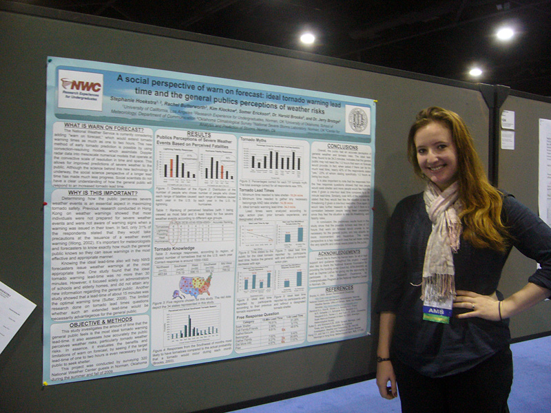
13. Examining tornado warning performance during supercell outbreaks
Mentors: Dr. Matt Flournoy (OU/CIMMS), Dr. Kenzie Krocak (CRCM), Alex Anderson-Frey (U. Washington), and Dr. Harold Brooks (NOAA/NSSL)
Increasing tornado warning lead time and probability of detection and decreasing false alarms remains an important operational goal. In the last few years, the mean lead time for tornadoes warned in advance (around 55% of all tornadoes) is around 16 minutes. This changes depending on how many tornadoes occur during an event, with more prolific outbreaks generally being better warned. However, skillfully predicting the first tornadoes of the day, even during outbreaks, remains a difficult challenge.
The goal of this project is to examine tornado warning performance for each tornado on a detailed storm-by-storm basis for several events. The student will compile this dataset and use it to examine differences in warning performance for each tornado (a) within the same storm, and (b) within different storms on the same day. How much lower is the mean lead time for the first tornado of the day than the rest? How much lower is the mean lead time for the first tornadoes of every storm? Does the mean lead time for each tornado within a storm typically increase after the first tornado? Answering questions like these will be the goal of this project.
Desired, but not necessary skills: interest in storms and tornadoes, programming experience (Python preferred)
Directly applicable majors: atmospheric sciences, mathematics
14. Examining Forecast Skill of Operational Convective-Allowing Models During High-Impact Severe Weather Events
Mentors: Dr. Larissa Reames (OU/CIMMS & NOAA/NSSL) and Dr. David Bodine (ARRC)
NOAA’s flagship global weather model, the Global Forecasting System (GFS) recently upgraded its dynamical core to the Finite Volume Cubed Sphere (FV3). FV3 is also used as the driving core in the weather model of NOAA’s next generation, community-driven modeling system, the Unified Forecast System (UFS). While the upgraded GFS has been operational for nearly two years, it is not yet well-documented how FV3-driven short-range models at convective-allowing model (CAM) scales perform. This project will investigate how FV3 simulations of high-impact severe weather events compare to those that use the Advanced Research WRF (ARW) and to observational data. This analysis will involve comparing simulation results using both model cores from the 2020 Spring Forecasting Experiment (SFE) to radar data, observed severe reports, and surface observations.
Desired skills: General programming and data visualization skills preferred (e.g., Python/Matlab)
Directly applicable majors: Atmospheric science, mathematics, physics
Exploring a novel multi-year boundary layer profiling dataset
Mentors: Dr. Elizabeth Smith (NOAA/NSSL); Co-Mentor: Tyler Bell (OU/CIMMS & NOAA/NSSL)
As a collaborative effort between the University of Oklahoma and NSSL, the Collaborative Lower Atmospheric Mobile Profiling System, or CLAMPS facilities have operated for over six years collecting thousands of hours of state-of-the-art, high-resolution thermodynamic and kinematic profile observations. This project will be part of a larger effort to modernize OU-NSSL boundary layer profiling program, by exploring and documenting the value and power of this novel dataset. In a team environment, the researcher will develop a catalog of existing datasets, help build modern data archival and access tools, contribute to design of future data collection and documentation strategies, and have the opportunity to develop and conduct independent research based on their own interests using these data with support of CIMMS and NSSL researchers.
Evaluating How the Planetary Boundary Layer Transitions in the Evening
Mentor: Tyler Bell (OU/CIMMS & NOAA/NSSL); Co-mentors: Dr. Elizabeth Smith (NOAA/NSSL) and Dr. Jacob Carlin (OU/CIMMS & NOAA/NSSL)
As a collaborative effort between the University of Oklahoma and NSSL, the Collaborative Lower Atmospheric Mobile Profiling System, or CLAMPS facilities have operated for over six years collecting thousands of hours of state-of-the-art, high-resolution thermodynamic and kinematic profile observations. This project will be part of a larger effort to modernize OU-NSSL boundary layer profiling program, by exploring and documenting the value and power of this novel dataset. In a team environment, the researcher will develop a catalog of existing datasets, help build modern data archival and access tools, contribute to design of future data collection and documentation strategies, and have the opportunity to develop and conduct independent research based on their own interests using these data with support of CIMMS and NSSL researchers.
Analyzing Forecaster Tornado Warning Decisions Using Talk-Aloud Data from the Prototype Probabilistic Hazardous Information (PHI) Project
Mentor: Dr. Daphne LaDue (OU CAPS)
In the 2017 Prototype Probabilistic Hazard Information (PHI) Project in NOAA's Hazardous Weather Testbed, researchers used a talk-aloud procedure to capture forecasters' thoughts while analyzing data and issuing tornado PHI objects. The same three cases were used each week, run in displaced realtime. Three forecasters rotated through the tornado PHI duties each week, resulting in three forecasters per case and nine forecasters overall working through the PHI warning strategy. Emergency Managers were also part of the experiment. They received tornado warning information, sometimes asked forecasters for additional decision support information, and made simulated operational decisions. The presence of EMs provided an audience to forecasters and likely increased their motivation to communicate well. These data allow opportunity to study how nine forecasters think through tornado warning decisions in a format where they specify their confidence that a tornado will occur in 5-min increments over the duration of warning time they set and have opportunity to provide decision support to emergency managers in a discussion box. Neither of these are currently communicated in tornado warnings.